The Role of Satellites and Remote Sensing in Monitoring Deforestation
A New Era of Forest Observation
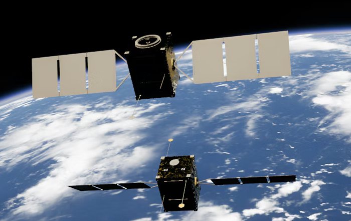
Satellites and remote sensing have become central tools for tracking deforestation by providing frequent, wide‑area, and increasingly high‑resolution views of forest cover change. Optical sensors (like those on Landsat and Sentinel‑2) detect changes in vegetation greenness and canopy structure, while radar satellites (such as Sentinel‑1 and SAOCOM) can see through clouds and smoke, making them especially valuable in tropical regions with persistent cloud cover. Time‑series analysis of these data allows scientists and governments to identify where forests are being cleared, distinguish between gradual degradation and outright deforestation, and assess the impact of policies or enforcement actions. Near‑real‑time alert systems built on this data—such as Brazil’s DETER and global platforms like Global Forest Watch—help authorities quickly spot new clearing, guide inspections, and support prosecutions. In addition, satellite‑based carbon and biomass estimates (from missions like GEDI and BIOMASS) are improving our ability to quantify emissions from forest loss, which is critical for climate reporting, REDD+ programs, and carbon markets.
In the last 24 hours, several outlets have highlighted new satellite‑based deforestation alerts in parts of the Amazon and Central Africa, noting that recent imagery shows fresh clearings linked to agricultural expansion and road building despite official commitments to curb forest loss. These reports emphasize how near‑real‑time satellite monitoring is enabling NGOs and journalists to rapidly document suspected illegal clearing and pressure local authorities for enforcement, underscoring the growing role of remote sensing data in public accountability around deforestation.
The global conversation about forests has moved decisively from whether deforestation matters to how precisely and rapidly it can be measured, managed, and ultimately reduced, and in this transition from uncertainty to evidence, satellites and remote sensing technologies have become the quiet infrastructure underpinning climate policy, sustainable finance, and corporate accountability. For YouSaveOurWorld.com, a platform dedicated to advancing sustainable living, responsible business, and global environmental awareness, the evolution of satellite-based forest monitoring is not simply a technological story but a foundational pillar of how societies understand their impact on the planet and how individuals, companies, and governments can align their actions with scientifically robust data. As the world confronts the intertwined crises of climate change, biodiversity loss, and unsustainable land use, the capacity to observe every hectare of forest, almost in real time, is reshaping expectations of transparency and responsibility across supply chains, investment portfolios, and public policy.
Why Forest Monitoring Matters in 2026
Forests remain one of the most powerful natural defenses against global warming, storing vast amounts of carbon, regulating regional climates, and supporting the livelihoods of hundreds of millions of people, yet they are also under relentless pressure from agricultural expansion, mining, infrastructure, and urban growth. According to FAO's global forest assessments, tropical deforestation and forest degradation continue to contribute a significant share of anthropogenic greenhouse gas emissions, while research summarized by the Intergovernmental Panel on Climate Change (IPCC) underscores that limiting warming to 1.5°C or even 2°C is far more difficult, if not impossible, without halting and reversing forest loss. For readers exploring the climate dimension on YouSaveOurWorld.com, understanding the role of forests in the global carbon cycle is central to any serious discussion of climate change, sustainable economies, and resilient communities.
Historically, forest monitoring relied on periodic field inventories, scattered case studies, and national reports that were often years out of date and sometimes politically influenced, leaving policymakers, investors, and citizens with an incomplete and inconsistent picture of what was happening on the ground. The emergence of high-resolution satellite imagery, sophisticated remote sensing algorithms, and open-data platforms has fundamentally changed this landscape by enabling near-real-time tracking of forest cover, degradation, and regrowth, making it far harder to hide unsustainable practices and far easier to reward credible progress. This data revolution is now deeply intertwined with the broader shift toward sustainable business, climate-aligned finance, and science-based targets, all of which depend on verifiable, comparable information about land-use impacts.
The Foundations of Satellite and Remote Sensing Technology
At its core, remote sensing is the science of obtaining information about Earth's surface without direct physical contact, using instruments mounted on satellites, aircraft, or drones to measure reflected and emitted radiation across different portions of the electromagnetic spectrum. Organizations such as NASA, the European Space Agency (ESA), and national space agencies in countries like India, Brazil, and Japan operate constellations of satellites that provide continuous coverage of the world's forests, offering a level of spatial and temporal detail that would have been unimaginable only a few decades ago. Readers interested in the broader intersection of science, technology, and sustainability can explore how digital tools and space-based infrastructure are reshaping environmental governance on YouSaveOurWorld's technology page.
Optical satellites, such as Landsat (operated by NASA and the U.S. Geological Survey) and Sentinel-2 (operated by ESA under the Copernicus program), capture reflected sunlight in visible and near-infrared bands, enabling analysts to distinguish forests from croplands, grasslands, and urban areas based on their spectral signatures. Radar satellites, including Sentinel-1 and missions from JAXA and ISRO, use microwave signals that can penetrate clouds and operate day and night, a critical advantage in tropical regions where persistent cloud cover has long hindered optical observations. Increasingly, commercial providers such as Planet Labs and Maxar Technologies offer very high-resolution imagery that can reveal individual logging roads, small clearings, and even selective logging, complementing the broad coverage of public missions and enabling more granular enforcement and verification.
From Raw Pixels to Actionable Forest Intelligence
The true value of satellite data emerges only when raw imagery is transformed into actionable information, and over the past decade, advances in cloud computing, machine learning, and open-source software have dramatically accelerated this transformation. Platforms such as Google Earth Engine allow researchers, governments, and civil society to process petabytes of satellite data without owning their own supercomputers, running sophisticated algorithms to detect changes in forest cover, biomass, and land use across time. Initiatives like Global Forest Watch, led by World Resources Institute, have built user-friendly interfaces on top of these data streams, providing public dashboards that show deforestation alerts, historical trends, and risk maps for regions, countries, and even individual concessions, thereby democratizing access to information that was once confined to specialized research institutions.
For the community around YouSaveOurWorld.com, this shift from opaque, technical data to accessible, interpretable insights is particularly important, as it enables business leaders, educators, and citizens to integrate forest information into their decisions and advocacy. A company seeking to align with sustainable living and responsible sourcing can now use satellite-based tools to monitor its supply chain regions, while educators can incorporate real-time forest maps into curricula that promote environmental awareness and climate literacy. The combination of open data, intuitive visualization, and analytical rigor is creating a shared factual basis for discussions that previously depended on anecdote or contested statistics.
Monitoring Deforestation: Speed, Scale, and Precision
One of the most transformative aspects of satellite-based monitoring is the ability to detect deforestation quickly, consistently, and across vast areas, which is critical for both law enforcement and market-based accountability mechanisms. The Global Land Analysis and Discovery (GLAD) lab at University of Maryland, for example, produces near-real-time forest loss alerts using Landsat and Sentinel data, which are then disseminated through platforms like Global Forest Watch and integrated into government and NGO monitoring systems. These alerts, updated weekly or even more frequently in some regions, allow authorities to identify new clearings within days rather than years, enabling interventions that can prevent further expansion or gather evidence for legal action.
Such rapid detection is particularly relevant for tropical countries participating in results-based payment schemes such as REDD+ (Reducing Emissions from Deforestation and Forest Degradation) under the UNFCCC, where verified reductions in deforestation can unlock climate finance from donor governments, multilateral funds, or private buyers. To ensure the integrity of these mechanisms, independent satellite-based estimates of forest loss are increasingly used to complement or challenge national inventories, reinforcing the importance of robust methodologies and transparent data-sharing. Those interested in the economic dimensions of forest conservation and climate finance can explore related themes on YouSaveOurWorld's economy page, where the interplay between natural capital, investment, and policy is a recurring topic.
Beyond Forest Loss: Degradation, Regrowth, and Quality
While early satellite-based deforestation maps focused mainly on complete forest clearance, the scientific and policy communities now recognize that forest degradation, regrowth, and quality are equally important dimensions that must be monitored to fully understand ecological and climate impacts. Degradation, which includes selective logging, understory fires, and fragmentation, can substantially reduce carbon stocks and biodiversity even when canopy cover appears largely intact, and detecting these subtler changes requires more sophisticated indicators derived from spectral indices, radar backscatter, and time-series analysis. Research groups collaborating with organizations such as CIFOR-ICRAF and the International Tropical Timber Organization have been developing methods to quantify degradation, which are gradually being incorporated into national forest monitoring systems and corporate risk assessments.
At the same time, remote sensing is increasingly used to track forest regrowth, restoration, and agroforestry expansion, providing essential information for evaluating the effectiveness of reforestation initiatives and nature-based climate solutions. Programs aligned with the Bonn Challenge and the UN Decade on Ecosystem Restoration rely on satellite data to document where trees are being planted or naturally regenerating, how rapidly biomass is accumulating, and whether restored areas are resilient to droughts, fires, and other disturbances. For those exploring innovation and design on YouSaveOurWorld.com, the integration of ecological restoration data into planning tools, financial models, and spatial decision-support systems illustrates how remote sensing is enabling more intelligent and adaptive approaches to land-use design and green infrastructure.
Corporate Accountability, Supply Chains, and Sustainable Business
By 2026, satellite-based monitoring has become an indispensable element of corporate environmental governance, particularly for companies with exposure to commodities such as soy, palm oil, beef, cocoa, and timber, which are major drivers of deforestation. Many multinational firms, under pressure from investors, regulators, and civil society, have adopted zero-deforestation commitments and are increasingly expected to demonstrate credible implementation rather than relying on broad policy statements. Satellite imagery, combined with geospatial data on farms, mills, and transport routes, allows companies and independent auditors to assess whether sourcing regions are associated with recent forest loss, whether suppliers are encroaching on protected areas, and whether remediation efforts are delivering measurable improvements.
Initiatives such as the Accountability Framework initiative and tools developed by CDP and Science Based Targets initiative (SBTi) encourage companies to use spatially explicit data in setting and tracking deforestation-related targets, aligning corporate strategies with global climate and biodiversity goals. Investors and financial institutions, guided by frameworks like the Taskforce on Nature-related Financial Disclosures (TNFD), are also beginning to use satellite-based forest risk indicators when evaluating portfolio exposure to nature-related risks, which has significant implications for capital allocation and corporate cost of capital. For businesses engaging with YouSaveOurWorld.com, the integration of remote sensing into sustainable business strategies is no longer optional; it is becoming a baseline expectation for demonstrating environmental due diligence, managing reputational risk, and aligning with emerging regulations in jurisdictions such as the European Union and the United Kingdom.
Public Policy, National Systems, and Global Governance
National governments are also increasingly dependent on satellite and remote sensing technologies to fulfill their international reporting obligations, design policies, and enforce environmental regulations. Under the Paris Agreement, countries submit Nationally Determined Contributions (NDCs) that often include forest-related targets, and accurate monitoring is essential for tracking progress and informing policy adjustments. Many tropical nations have invested in national forest monitoring systems that combine satellite data with ground-based inventories, supported by technical assistance from organizations like FAO, UN-REDD Programme, and bilateral cooperation agencies, creating institutional capacities that extend beyond climate reporting to land-use planning, disaster risk management, and agricultural policy.
At the multilateral level, initiatives such as the Global Observations of Forest and Land Cover Dynamics (GOFC-GOLD) and the Group on Earth Observations (GEO) foster collaboration among space agencies, research institutions, and governments to harmonize methodologies, share best practices, and improve the comparability of forest data. These efforts are crucial for building trust among countries, ensuring that forest-related climate finance is based on robust and consistent metrics, and enabling global assessments of progress toward goals such as halting deforestation by 2030. Readers interested in the broader global governance context and the role of international cooperation in sustainability can find complementary perspectives on YouSaveOurWorld's global page, where issues of equity, transparency, and shared responsibility are frequently examined.
Waste, Degradation, and the Link to Everyday Consumption
Deforestation is not an abstract phenomenon disconnected from daily life; it is closely tied to patterns of consumption, waste, and lifestyle choices that determine demand for land-intensive products and materials. Packaging waste, single-use plastics, and poorly managed supply chains can indirectly drive land conversion by increasing demand for virgin raw materials, while unsustainable diets and food loss intensify pressure on agricultural frontiers. Satellite-based monitoring, by making land-use change visible and traceable, helps connect these distant impacts to consumer markets and urban lifestyles, reinforcing the message that responsible waste management and plastic recycling are integral to broader land and climate strategies rather than isolated environmental issues.
For individuals and businesses engaging with lifestyle content on YouSaveOurWorld.com, the knowledge that satellites can reveal the footprint of supply chains offers both a challenge and an opportunity: a challenge because it becomes harder to ignore the consequences of consumption, and an opportunity because transparency enables more informed choices, certification schemes, and advocacy. When satellite data shows that deforestation rates decline in regions where sustainable sourcing initiatives are implemented, it provides tangible evidence that changes in consumer behavior and corporate practice can translate into measurable environmental benefits, strengthening the case for integrated approaches to sustainable living, circular economy, and land stewardship.
Education, Capacity Building, and Public Engagement
The proliferation of accessible satellite-based forest data has opened new avenues for education, citizen science, and capacity building, which are essential for sustaining long-term progress in forest conservation. Universities, schools, and training programs increasingly incorporate remote sensing modules into curricula for environmental science, geography, and business, equipping the next generation of professionals with the skills to interpret satellite imagery and integrate spatial data into decision-making. Organizations such as NASA's SERVIR program, in partnership with USAID, work with regional hubs in Africa, Asia, and Latin America to build local capacity in using Earth observation data for land management, climate adaptation, and disaster response, thereby reducing dependence on external expertise and fostering locally grounded solutions.
For the audience of YouSaveOurWorld.com, which includes educators, learners, and professionals seeking to deepen their understanding of sustainability, satellite-based forest monitoring offers compelling educational content that can be integrated into education initiatives, workshops, and digital resources. Interactive maps, time-lapse visualizations, and case studies based on remote sensing data make abstract concepts such as land-use change, carbon fluxes, and ecosystem resilience more concrete and engaging, helping to build a culture of informed environmental citizenship. As more open data becomes available, the potential for community-based monitoring, participatory mapping, and youth-led projects increases, turning remote sensing from a purely technical domain into a powerful tool for civic engagement and empowerment.
Well-Being, Resilience, and the Human Dimension
While much of the discussion around satellite monitoring focuses on data, systems, and institutions, it is essential to remember that deforestation is ultimately a human story, affecting health, livelihoods, cultural identity, and psychological well-being. Forests provide ecosystem services such as clean water, climate regulation, and food security that underpin community resilience, and their loss can exacerbate vulnerabilities, especially for Indigenous peoples and rural populations. Remote sensing, by illuminating where and how forests are changing, can support more equitable and inclusive decision-making that recognizes the rights and knowledge of local communities, provided that data is used responsibly and in conjunction with participatory processes.
For individuals exploring personal well-being on YouSaveOurWorld.com, the connection between healthy ecosystems and human flourishing is increasingly evident, as research from institutions such as World Health Organization (WHO) and UN Environment Programme (UNEP) highlights the links between environmental degradation, air quality, infectious disease risks, and mental health. When satellite data reveals the retreat of forest cover around cities, it is not only a climate concern but also a signal about the future quality of life, access to nature, and resilience to heatwaves and floods. Conversely, documented gains in urban and peri-urban tree cover, restoration projects, and protected area expansion can be understood as investments in societal well-being, not merely conservation achievements.
Challenges, Limitations, and the Path Forward
Despite its transformative potential, satellite-based forest monitoring is not without challenges and limitations, and recognizing these is critical for maintaining trust and avoiding overreliance on any single data source. Cloud cover, sensor limitations, and classification errors can introduce uncertainties, particularly in complex landscapes where plantations, secondary forests, and agroforestry systems intermingle, making it difficult to distinguish between different types of tree cover and land uses. Furthermore, the interpretation of deforestation data is inherently political, as choices about baselines, definitions, and thresholds can influence whether a given jurisdiction or project appears successful or failing, underscoring the need for transparent methodologies and inclusive governance of monitoring systems.
Data privacy and equity concerns also arise when high-resolution imagery is used to monitor activities in rural areas, raising questions about consent, surveillance, and the potential misuse of information. Ensuring that local communities have access to the data and the capacity to use it, rather than being only subjects of external monitoring, is a key ethical consideration that organizations and governments must address. As artificial intelligence and automation play a larger role in analyzing satellite data, there is also a risk that opaque algorithms could shape decisions without adequate scrutiny or local contextualization, which makes human oversight, interdisciplinary collaboration, and open-source approaches all the more important.
Integrating Satellite Insights into a Holistic Sustainability Strategy
For YouSaveOurWorld.com and its community of readers, the role of satellites and remote sensing in monitoring deforestation should be understood not as a standalone technological solution but as a critical component of a broader sustainability strategy that spans business, policy, lifestyle, and culture. The same ethos that guides responsible business practices, circular waste management, and climate-conscious lifestyle choices also supports the responsible use of Earth observation data: transparency, accountability, inclusiveness, and a commitment to long-term resilience. By linking satellite-based evidence with on-the-ground action, education, and policy reform, societies can move beyond reactive responses to deforestation and toward proactive, science-informed stewardship of forests as critical assets for the global economy and human well-being.
In 2026 and beyond, satellites will continue to orbit silently above Earth, capturing the evolving story of the planet's forests in ever greater detail, but it is the decisions made on the ground-by governments, companies, communities, and individuals-that will determine whether those images document continued loss or a turn toward regeneration. Platforms like YouSaveOurWorld.com, which bridge technical knowledge and practical guidance across themes such as sustainable living, climate change, innovation, and global cooperation, have a vital role to play in ensuring that the unprecedented visibility offered by remote sensing translates into informed choices and collective action. As satellite and remote sensing capabilities continue to advance, the imperative is clear: to use this powerful vantage point not merely to observe deforestation, but to help end it.